UnderLA - Refik Anadol and Peggy Weil 2016
by Peggy Weil
LOS2 Descent from -10′ to -1400′
Video sequence of soil samples taken from LOS-2, a monitoring well located just south of downtown Los Angeles less than a block west of the LA River.
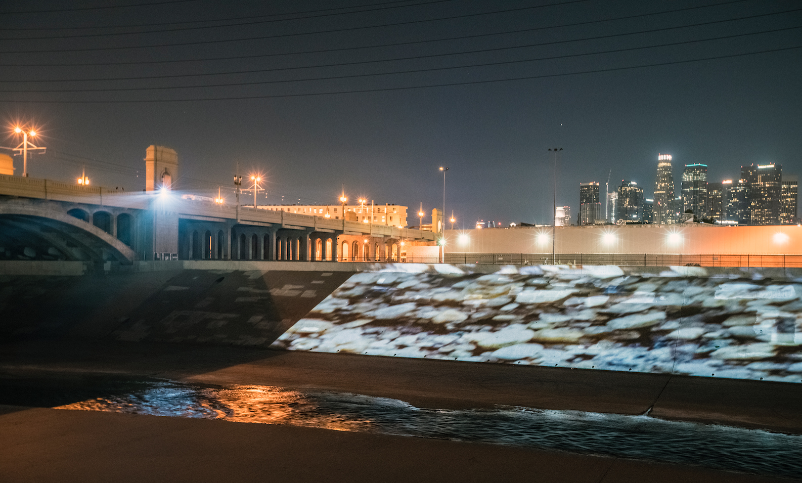
UnderLA: First Street Bridge 2016 Photo by Refik Anadol Studio Artwork,
commissioned by DCA for CURRENT:LA Water Refik Anadol + Peggy Weil
Video sequence of soil samples taken from LOS-2, a monitoring well located just south of downtown Los Angeles less than a block west of the LA River.
UnderLA: First Street Bridge 2016 Photo by Refik Anadol Studio Artwork,
commissioned by DCA for CURRENT:LA Water Refik Anadol + Peggy Weil
TORR2 Descent from -10 to -1280′ Video sequence of soil samples taken from TORR-2, a monitoring well located In Torrance
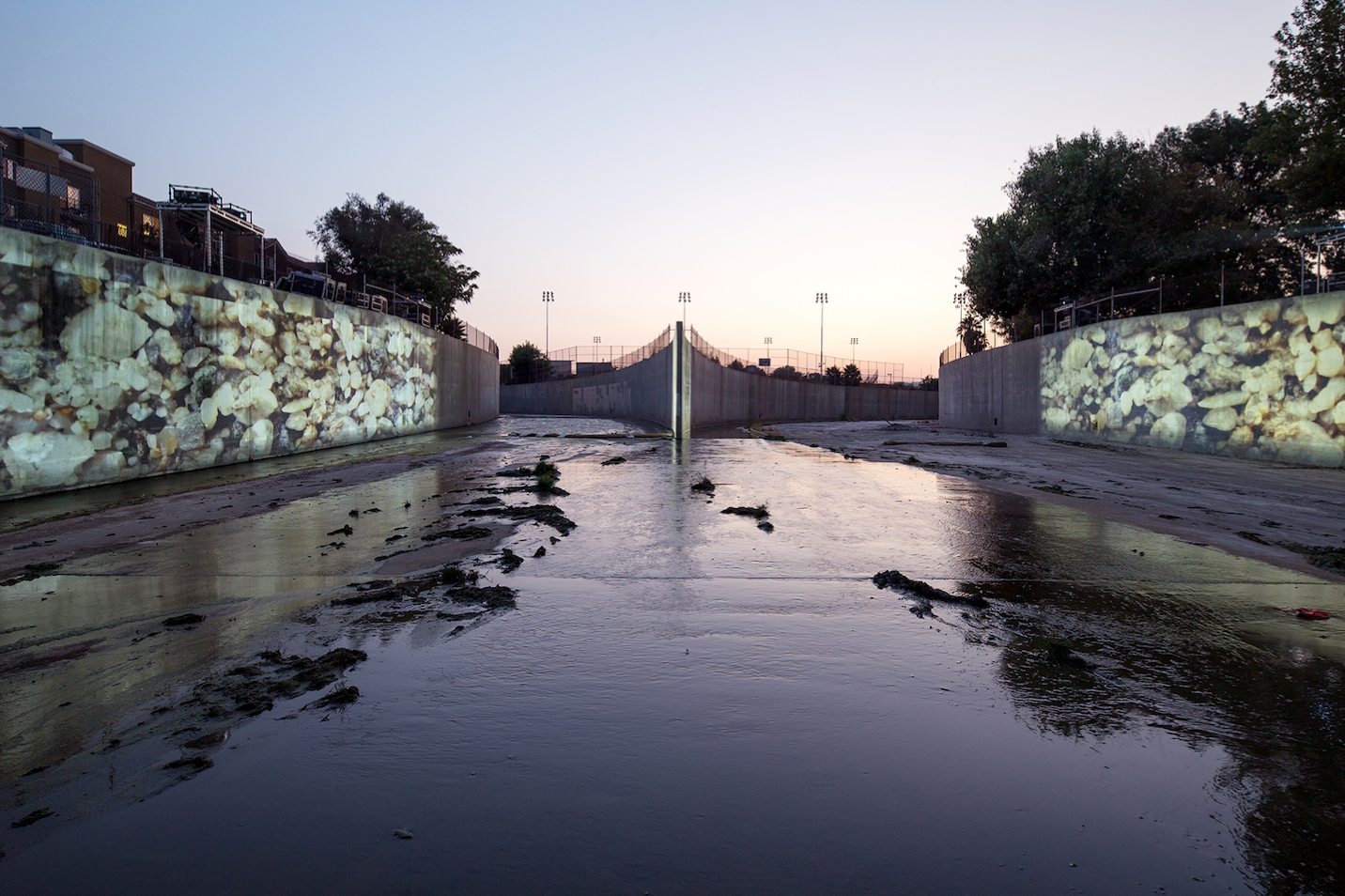
UnderLA: Origin of LA River Photo by Panic Studio LA, courtesy of City of Los Angeles Department of Cultural Affairs (DCA) Artwork,
commissioned by DCA for CURRENT: LA Water Refik Anadol + Peggy Weil
UnderLA: Origin of LA River Photo by Panic Studio LA, courtesy of City of Los Angeles Department of Cultural Affairs (DCA) Artwork,
commissioned by DCA for CURRENT: LA Water Refik Anadol + Peggy Weil
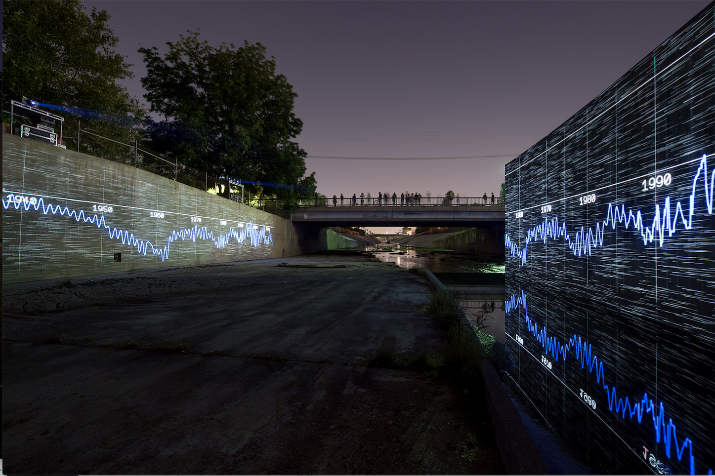
Hydrograph Data Visualization Wells Water Levels – Monitoring Wells 2778/LOS2 & 906D
Data provided by the Water Replenishment District of Southern California (WRD)
UnderLA: Origin of LA River Photo by Panic Studio LA, courtesy of City of Los Angeles Department of Cultural Affairs (DCA) Artwork,
commissioned by DCA for CURRENT: LA Water Refik Anadol + Peggy Weil
Data provided by the Water Replenishment District of Southern California (WRD)
UnderLA: Origin of LA River Photo by Panic Studio LA, courtesy of City of Los Angeles Department of Cultural Affairs (DCA) Artwork,
commissioned by DCA for CURRENT: LA Water Refik Anadol + Peggy Weil
A projection of the Los Angeles Aquifer onto the banks of the Los Angeles River. A collaboration between Refik Anadol and Peggy Weil, UnderLA was commissioned by the City of Los Angeles for CURRENT:LA Water for two sites: The First Street Bridge and The Origin of LA River Park.
http://underlawater.com/
https://pweilstudio.com/project/underla/